Atlas editions / Monograph 02
The Paper Archipelago
How a missing island exposed a break in the map’s evidence chain
6 min read
Begin readingMonographs02
The argument
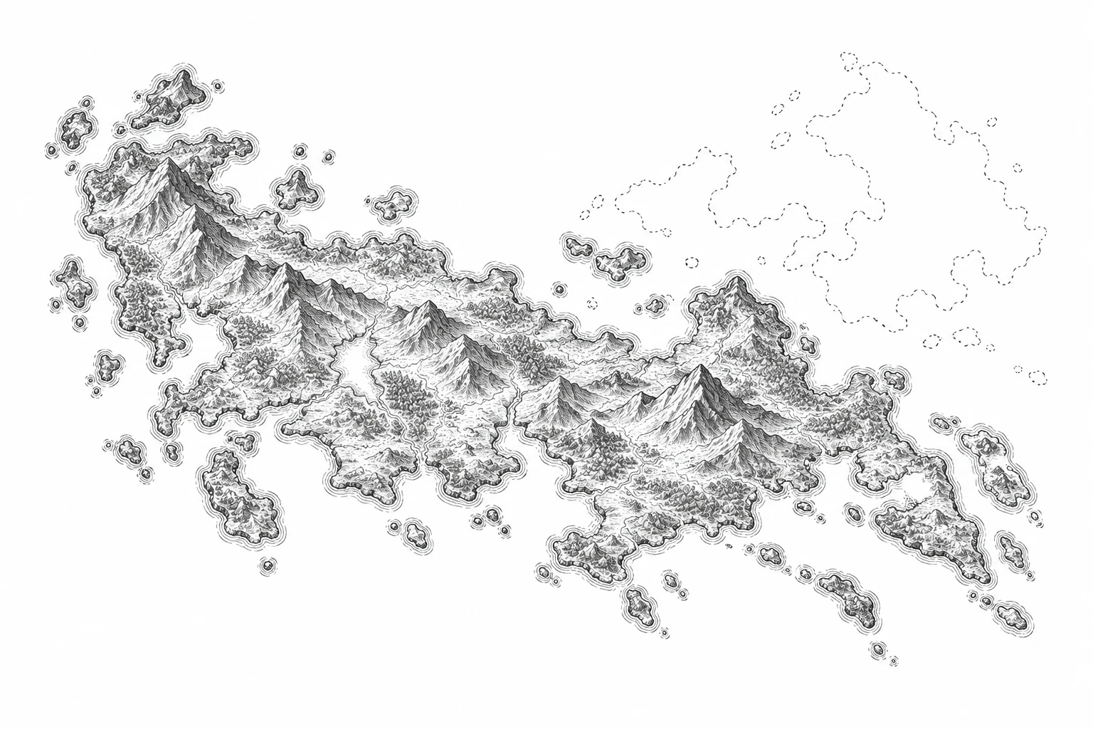
Sandy Island persisted in scientific datasets after hydrographic charts had removed it. Following that disagreement reveals how several products can repeat one inherited error. I use the case to propose a correction record that preserves the distinction between an observation, a copied outline and an unresolved hypothesis.
In this monograph
01The chart on the bridge knew better
During the Southern Surveyor’s October 2012 voyage, hydrographic charts omitted Sandy Island while scientific datasets retained it. The expedition found open water. Seton and colleagues (2013) trace the relevant report to the Velocity in 1876, distinguishing Cook’s differently located island.
The important discovery is therefore more awkward than the familiar story of a modern ship correcting an ancient mistake. A correction already existed. The question is how a system could know something in one place and continue publishing its opposite elsewhere. The chart on the bridge and the coastline on a researcher’s screen had different histories, although both appeared to describe the same sea.
A coastline gives an uncertain report a very definite body. It has vertices, an interior and a label. Software can select it, calculate its area and use it to decide which observations belong to land. The mark becomes operational long before a reader asks what originally justified drawing it. Its usefulness helps conceal its uncertainty: a file that fits the next operation is easy to accept as a file that knows the place.
That is the argument of this essay. A map’s authority depends partly on the route by which evidence reaches it. An interface that shows the latest rendering while hiding that route can give an inherited statement the appearance of a fresh observation. Correcting the rendering is necessary, but a durable repair also has to explain which dependency was wrong and which versions still depend on it.
How a cartographic claim travels
- 01Sighting
An observation is interpreted.
- 02Chart
The claim becomes a symbol.
- 03Copy
A later chart repeats it.
- 04Dataset
The symbol becomes a polygon.
A conceptual chain of transmission: sighting, chart, copied chart, digital coastline. Repetition can preserve a claim without supplying a new observation. This is a process diagram, not a reconstruction of a particular chart’s genealogy.
Seton et al. · Pass the pumice ↗02A plausible origin is still a hypothesis
Seton and colleagues record French chart removals in 1974 and Australian removals in 1985. They offer a pumice raft as a possible explanation for the sighting, without establishing what the crew saw.
An attractive origin story can collapse those states. Floating stone, a lookout and a mistaken outline make a coherent sequence; coherence alone cannot tell us whether that sequence occurred. I would leave the original encounter unresolved. That choice does not weaken the later correction. We can reject a particular coastline without being able to reconstruct every step that produced it.
The distinction matters when writing a source note. “Reported in 1876” identifies a historical record. “Possibly a pumice raft” identifies an explanation offered later. “Removed from a particular chart edition” describes an editorial action. If the note merges these into one sentence about what really happened, it supplies certainty at precisely the point where the archive should preserve a gap.
This also limits the romance of the phantom island. A doubtful sighting does not demonstrate that every map is arbitrary, or that direct observation settles every cartographic dispute. Position, tide, instruments and the purpose of a survey still matter. The defensible lesson is narrower: the evidence for an object and the evidence for its history must remain distinguishable.
A silhouette is not a sounding
A distant shape can be ambiguous.
A sounding tests the depth at a location.
Compare a distant visual impression with a depth measurement. The drawing is illustrative; the cited Sandy Island investigation provides the observed evidence.
Read the oceanographic report ↗03Agreement is not independence
The report traces the persistent outline to World Vector Shoreline and derived products, including land masks that excluded ocean observations. Those agreeing outputs could share one input, rather than supply independent sightings (Seton et al., 2013).
Consider a deliberately simplified example. File A contains a land polygon. File B copies A’s outline into a coastline layer. File C uses B to suppress water measurements inside the polygon. A reader sees an outline in B and missing ocean values in C, then treats the two displays as corroboration. But C’s absence is conditional on B’s classification. It has supplied no new observation of an island.
Now remove the polygon from A. B and C remain wrong until their dependencies are rebuilt or revised. Merely adding a correction banner to A will not repair a cached copy of B. Merely refreshing C’s measurements will not help if its old mask still discards them. The correction needs an address: which object, which source version, which downstream operation, and which replacement state? This example is a teaching model of dependency, not a reconstruction of the expedition’s software.
W3C’s PROV-O vocabulary provides a useful distinction here. It can describe an entity as derived from another entity, and distinguish a revision from other derivations. Those relationships help name the chain. They do not establish that an observation was accurate, nor do they automatically deliver a correction to every consumer. Provenance describes an obligation that the surrounding workflow still has to fulfil.
04Give the correction somewhere to go
For an archive, I would make a correction record as specific as the original feature. It would identify the superseded source version and feature, link the contrary evidence, state the revised classification, and list the derived outputs known to need attention. It would keep the old representation available as history while ensuring that a present-day export clearly identifies the corrected edition. This is a proposed editorial contract, not a claim that Cartologium already implements a dependency registry.
The difficult choice is between a clean current map and an inspectable history. Keeping every obsolete outline on the main map would burden the reader and might make the old island appear live again. Deleting every trace would hide how the mistake circulated. I prefer a clear current view with a reachable edition record: the corrected map first, the superseded geometry in the correction note, and explicit links between them.
Even that record will have limits. A publisher may know its own exports without knowing every private download, printed map or third-party derivative. It should describe the consumers it actually checked and leave the others unresolved. “Corrected in this edition” is a useful promise. “Corrected everywhere” would require evidence the publisher rarely possesses.
Sandy Island offers a precise reason to ask about sources. Counting agreeing screens is not enough; we have to ask what each screen observed and what it inherited. The ocean did not change when the polygon disappeared. The useful improvement was in the representation and in our ability to inspect the route by which it had become persuasive. A correction earns its place in an archive when that route becomes easier to follow.
Publication details
The colophon
- Author
- Evelyna Bellamy
- Published
- April 2, 2026
- Revision
- 2026-10-10
- Edition
- Cartologium · Online edition
- Length
- 1,018 words · 6 min read
Bellamy, E. (2026, April 2). The Paper Archipelago. Cartologium. https://cartologium.com/monographs/the-paper-archipelago
Further reading / APA 7th edition
Sources & citations
- 01
Seton, M., Williams, S., Zahirovic, S., & Micklethwaite, S. (2013). Obituary: Sandy Island (1876–2012). Eos, Transactions American Geophysical Union, 94(15), 141–142.
Primary expedition report: chart history, inherited coastline and proposed pumice explanation. Bibliographic metadata checked against Crossref; the sighting’s origin remains unresolved.
- 02
Lebo, T., Sahoo, S., & McGuinness, D. (Eds.). (2013, April 30). PROV-O: The PROV ontology. World Wide Web Consortium.
Primary technical recommendation, sections 3.1 and 4: derivation and revision relationships. It describes provenance representation, not a guarantee of factual accuracy or correction delivery.
View original reference plate