Atlas editions / Monograph 04
The Mind's Meridian
A Constructed Journey Between a Diagram and a Street
4 min read
Begin readingMonographs04
The argument
A transit diagram can make connections legible while leaving a traveler unprepared for the exit. Using a declared fictional journey, this essay distinguishes Lynch’s study of city imageability, Beck’s diagrammatic map and the author’s proposal for handing a reader from network structure to street-level action.
In this monograph
01The wrong exit
Consider a fictional traveler named Mira. She has to reach a clinic across a river. A transit diagram shows one interchange, two more stops and a short final walk. She understands the train sequence immediately. At the destination station she takes an exit on the wrong side of a divided road, then learns that the direct footbridge has stairs. The route was connected; the journey was not yet usable.
This is a teaching scenario, not a reported usability study or a real London itinerary. The stations, clinic and obstacles are invented. It lets us inspect which information a representation carries and which information a traveler must recover elsewhere. We should not turn Mira’s fictional difficulty into a measured failure rate for transit maps.
Beck’s 1933 Underground diagram, held by London Transport Museum, is an identified historical artifact. Its value here is the diagrammatic treatment of a network, not a universal claim that distance never matters. Lynch’s The Image of the City develops imageability through studies of Boston, Jersey City and Los Angeles. The books and diagram pose related questions about legibility, but they are neither the same method nor evidence for this invented journey.
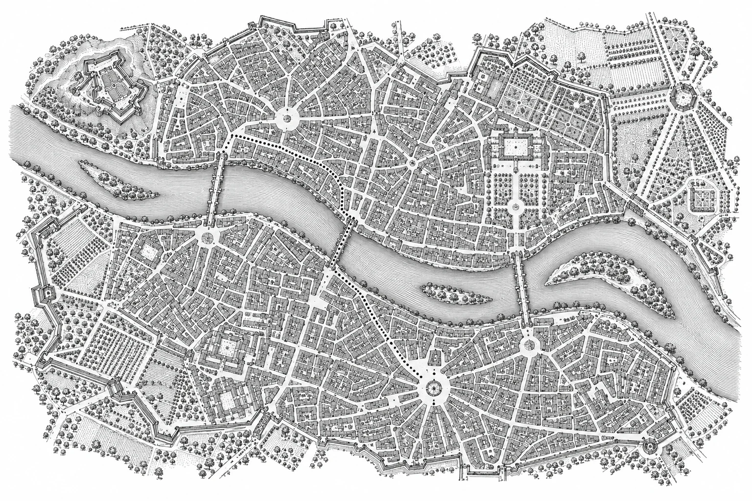
Five elements of a legible city
- Path A route through the city.
- Edge A boundary, such as a river.
- District An area with a shared character.
- Node A junction or gathering point.
- Landmark A recognizable reference.
An invented neighborhood illustrating Lynch’s paths, edges, districts, nodes and landmarks. The symbols are a reading key, not observations from a real city.
Lynch · The Image of the City ↗02Two models of the same journey
In the network model, Mira’s task is to identify a service, a transfer and a destination. We can express it as A → B → C, with an interchange at B. Replacing literal angles and spacing with a regular drawing can clarify those relations. It does not by itself report frequency, disruption, fares, accessibility or the time needed to cross a station.
In the street model, C is no longer one node. It has exits, road crossings, gradients and several possible paths to the clinic. A geographically shorter path may be unusable for a wheelchair user or someone carrying luggage. A longer path may be the only continuous step-free route. These are stipulated properties of the example; an actual guide would need current, verified infrastructure information.
Put a hypothetical four-minute walk beside the route and the number acquires authority. What walking speed, entrance, crossing delay and accessibility assumption produced it? Without those inputs, the number conceals precisely the handoff that failed. Distance remains important, but its usefulness depends on how it is converted into a task estimate.
Keep the connections, simplify the journey
Distances and angles vary.
Station order A–B–C–D is preserved.
The same four stations appear in the same order in both diagrams. One traces a winding route; the other regularizes its geometry. A conceptual demonstration, not a reproduction of Beck’s London map.
London Transport Museum · Beck’s 1933 map ↗03A handoff contract
I would preserve the readable diagram for the service choice, then offer a street view at the point where exits matter. The route should identify the exit it assumes and the final destination entrance. An accessibility choice should change the path, rather than merely place a badge on an unchanged shortest route. Unknown infrastructure should remain unknown until checked.
This does not require one map to contain everything. Adding all slopes, service patterns, road widths and entrances to the network diagram can destroy the simplification that made it useful. The design problem is to let the traveler cross between representations without losing the meaning of a selected route.
There are limits to the proposed repair. Live information can be late; lifts can fail; an entrance can close. A handoff needs the timestamp and provenance of those claims, and a recovery path when they are wrong. A diagram that is easy to memorize and a route that works today are different achievements.
A useful test would ask participants to choose a service and then identify an accessible exit using the actual information supplied. It would record mistakes and recovery as well as completion. No such experiment is reported here. The scenario establishes an inspectable design question, not an answer about all travelers.
The mind’s meridian is the point at which a representation becomes a plan of action. I am less interested in calling a map cognitively correct than in asking what its reader can safely carry into the street. A good abstraction should make that next step easier to understand and easier to revise.
Publication details
The colophon
- Author
- Evelyna Bellamy
- Published
- June 1, 2026
- Revision
- 2026-10-11
- Edition
- Cartologium · Online edition
- Length
- 677 words · 4 min read
Bellamy, E. (2026, June 1). The Mind's Meridian. Cartologium. https://cartologium.com/monographs/the-minds-meridian
Further reading / APA 7th edition
Sources & citations
- 01
Lynch, K. (1960). The image of the city. MIT Press. https://mitpress.mit.edu/9780262620017/the-image-of-the-city/
Publisher record identifies the original book and three-city study. No new empirical claim is inferred from the fictional journey.
- 02
Beck, H. C. (1933). Map of the Underground [Transit diagram]. London Transport Museum. https://artsandculture.google.com/asset/map-of-the-underground-henry-c-beck/oQHAlLEieHMXTA
Museum-attributed primary artifact; diagrammatic representation. The invented journey is not a journey on this historical service network.
View original reference plate