

WAYS OF MAPPING / NAMES & BELONGING
A name
is a layer.
A mountain does not begin with its label. What does a name carry—and whose record are we reading?
Read the name layers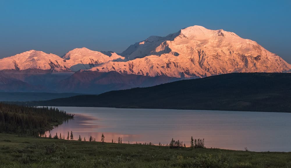
NPS Photo / Kent MillerSource & rights +
Mountain in alpenglow. NPS Photo / Kent Miller. Full source frame, resized without recoloring; capture date unrecorded on the source page. This photograph is a view of the place, not a historical image for each selected year.
Public-domain NPS photograph, credited on the source page to NPS Photo / Kent Miller without a copyright restriction. NPS-produced government information is public domain unless otherwise identified. The source page does not supply a capture date.
No claim to original U.S. Government works.
Open source record ↗Open original image ↗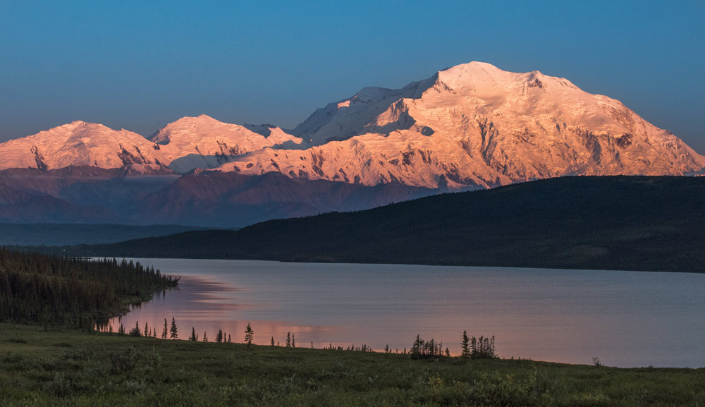
The word is older than the form.
A map label is small. The relationships behind it can be immense: language, family memory, travel, political authority, attachment to the land. When we read only the printed word, those relationships can disappear into the apparent simplicity of a name.
Consider the mountain called Denali and Mount McKinley. The National Park Service traces “Denali” to Koyukon deenaalee. Drawing on linguist James Kari, it distinguishes names in languages to the north and west, associated with tallness, from southern names associated with a large mountain. There is no single name shared by every Alaska Native language.
Our comparison follows one Koyukon-derived form into selected state and federal documents. Its first column is not a birth certificate for the name. An administrative date can tell us when an institution made a decision; it cannot establish when a community first knew a place.
One mountain. Parallel records.
Choose a year. Watch the federal label, then compare it with Alaska’s recognition. The language layer stays alongside them. These layers describe different kinds of relationship to a place, so they need not move together.
One place.
Parallel names.
- Language & continuity
- DenaliKoyukon-derived English form · no first-use date asserted
- Alaska state recognition
- DenaliState designation in 1975; reaffirmed in the 2025 resolution
- Federal record
- Mount McKinleySecretary’s Order 3424 · 14 February 2025
The federal label changes again.
Secretary’s Order 3424, dated 14 February 2025, implements the January executive order and supersedes the 2015 order. Alaska’s 2025 resolution continues to support Denali. The surrounding national park keeps its name.
Read all three dated records
| Record | Alaska | Federal |
|---|---|---|
| 1975 | Denali | Mount McKinley |
| 2015 | Denali | Denali |
| 2025 | Denali | Mount McKinley |
The 2025 cell describes Order 3424, following the January executive order. These are selected documents, not every step of the decision process.
In the 2015 record, two official labels coincide. In the 2025 record, they diverge again. This is why a naming history needs more than a list of “old” and “new” words. It needs an institution, a scope and a date attached to each decision.
and Preserve
The mountain and the park are different named features. Order 3424 explicitly retains the park’s name. Searching for one can return pages about the other; the feature being named matters as much as the word.
Let the old map keep its words.
On this 1909 federal map, the mountain is printed as “Mt. McKinley.” Move from the name to the title, then back to the full sheet. Each view answers a different question: what does it say, who published it, and where does the label sit?
Enlarge the selected map window +
Library of Congress, Geography and Map DivisionSource & rights +
Map of Alaska — 1909. U.S. Geological Survey, 1909. Full scan retained, including title, date, scale, border and inset. Detail windows are editorial crops; historical lettering is unchanged.
Public-domain U.S. federal government map, published in 1909. The Library of Congress item’s Rights & Access statement permits free use and reuse; no item-specific restriction is listed. Credit: Library of Congress, Geography and Map Division.
No claim to original U.S. Government works.
Open source record ↗Open original image ↗
The mountain’s label · 1909
Find “Mt. McKinley” among the rivers and neighboring peaks. This is evidence of wording on this particular 1909 map. The printed height belongs to the historical source; it is not a current elevation measurement.
The sheet is a source for a statement about itself: this publisher used this wording in this edition. It cannot stand for every name spoken in the surrounding landscape. The presence of a printed label is evidence; the absence of another is not proof that nobody used it.
We preserve the scan’s lettering. Replacing a historical label inside the image would blur the distinction between the source and our explanation. A contemporary note can sit beside the map, giving readers access to both the old document and the history that followed.
A name has speakers, too.
Denali
Responding to the 2025 executive orders, Tanana Chiefs Conference reaffirmed its support for Denali and said it would work with Tribal communities and the National Congress of American Indians to retain the name.
Tanana Chiefs Conference · paraphrase of its published statement
This is an attributed organizational position, with a date and a source. It belongs beside the administrative documents because it answers another question: how are people responding to the decision? It does not speak for every individual or every Alaska Native people.
“A name is a layer” is a reading method. Keep the place, the word, the speaker, the institution and the document date in view. Then ask what your map makes visible—and what you would need another source to understand.
Give a familiar name its context.
Choose a place you know. Find a dated map and one account from people connected to it. Record the exact wording, language where known, named feature, source and date. Which differences concern spelling? Which concern authority, memory or the feature itself? Keep unknowns visible.
Sources & method
National Park Service. (2025, March 26). Naming a mountain. Denali National Park & Preserve. Open source ↗
Alaska State Legislature. (2025). Enrolled HJR 4: Urging the President of the United States, the United States Secretary of the Interior, the United States Board on Geographic Names, and the members of the state’s delegation in Congress to maintain Denali as the official name for the tallest mountain in North America [34th Legislature]. Open source ↗
U.S. Department of the Interior. (2015, August 28). Change of the name of Mount McKinley to Denali (Secretary’s Order No. 3337). Open source ↗
U.S. Department of the Interior. (2025, February 14). Mount McKinley and landmarks honoring the Alaskan people (Secretary’s Order No. 3424). Open source ↗
Tanana Chiefs Conference. (2025, January). TCC responds to executive orders from the Trump administration and their impact on the region. Open source ↗
U.S. Geological Survey, Brooks, A. H., & U.S. Coast and Geodetic Survey. (1909). Map of Alaska [Map]. Library of Congress, Geography and Map Division. https://www.loc.gov/item/2012586808/ Open source ↗
The interactive comparison reads selected decisions from 1975, 2015 and 2025. The February 2025 order follows a January executive order; the year selector does not imply that every change happened on the date of the selected document. The state’s enrolled 2025 resolution records its 1975 designation and its continued support for Denali. This is a curated documentary reading reviewed on 13 October 2026, not a live geographic-names feed.
The NPS linguistic account supplies the limited language comparison; Tanana Chiefs Conference supplies its own organizational position. We make no claim to a complete naming history or to a first-use date for an oral place name. The TCC page displays January 2025 publication/update dates; its citation is given at month precision.
The photograph and map are public-domain U.S. Government works, with source-specific credits beside the images. Local JPEG copies preserve source colors and full frames. The map reader selects windows in image pixels, with a matching locator; it does not georeference the scan. The photograph’s capture date is not supplied on its source page. No claim to original U.S. Government works. The social image is an original schematic Cartologium composition, not measured terrain.