
Return to Projection Lab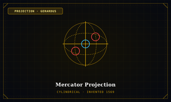
Cylindrical Family·Inventor: Gerardus Mercator·Year: 1569
Mercator Projection
MATHEMATICAL SPECIMEN · MERCATOR
"Conformal navigation grid where lines of constant compass bearing are straight lines"
Engineered strictly as a marine navigation tool, Mercator stretches latitude intervals toward the poles at the exact rate needed to preserve loxodromes (rhumb lines) as straight lines. This produces monumental area inflation in polar latitudes.
Forward Mathematical Formulation
X-COORDINATE:
x = R (\lambda - \lambda_0)Y-COORDINATE:
y = R \ln \left[ \tan\left(\frac{\pi}{4} + \frac{\phi}{2}\right) \right]DIFFERENTIAL METRIC:
h = k = \sec \phiCartographic Application & Critique
Primary Applications: Nautical navigation, Marine rhumb line plotting, Web Slippy Maps (EPSG:3857).
Critical Analysis: When co-opted into classrooms and wall atlases, Mercator visually inflates imperial powers in North America and Europe while drastically shrinking the African continent, South America, and the equatorial belt.
TISSOT INDICATRIX (Lat: 60°N)Area: 4.00×
MERIDIAN (h)
2.00
PARALLEL (k)
2.00
ANGULAR (2θ')
0.0°
Tissot Profile Across Latitudes
| LATITUDE | SCALE h | SCALE k | AREA hk | 2θ' DEFORM |
|---|---|---|---|---|
| 0°N | 1.00 | 1.00 | 1.00× | 0.0° |
| 30°N | 1.16 | 1.16 | 1.33× | 0.0° |
| 60°N | 2.00 | 2.00 | 4.00× | 0.0° |
| 80°N | 5.76 | 5.76 | 33.16× | 0.0° |
Interdisciplinary Geometric Links
Astronomical EphemerisCALCULATED_BY
Rhumb Line Navigation
Jurisprudence & CadastrePROJECTED_ON
UNCLOS Maritime Baselines
The Chromologium (Color Physics)INFLUENCED_BY
High-Latitude Halation
Academic Provenance: Mercator, G. (1569)