

Waldseemüller World Map (Universalis Cosmographia, 1507)
"The 'Birth Certificate of America': The first printed map to apply the name 'AMERICA'"
Created in Saint-Dié-des-Vosges, France, this monumental 12-panel wall map is the only surviving copy of 1,000 printed. It was the first map to depict the Western Hemisphere separated from Asia by a distinct Pacific Ocean.
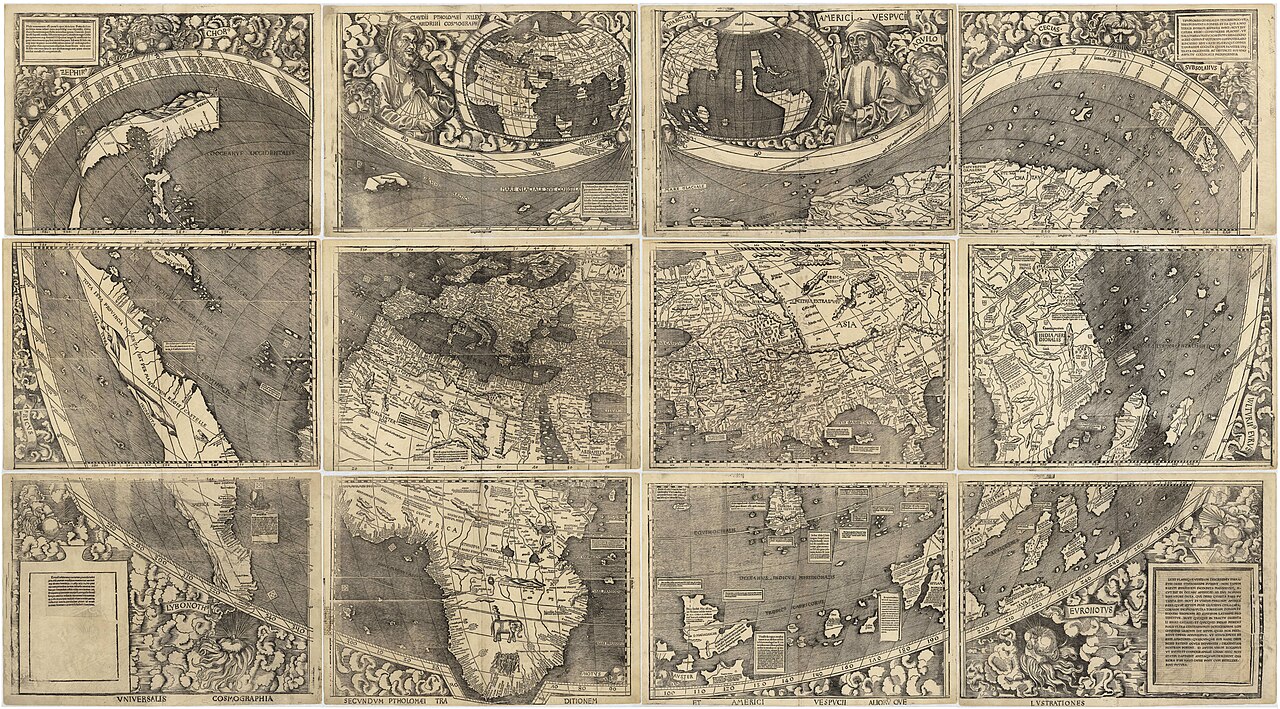
- The word 'AMERICA' printed across South America
- Inset portrait of Amerigo Vespucci alongside Ptolemy
- Depiction of the Pacific Ocean six years before Balboa sighted it in 1513
Image credit and reuse
Waldseemüller World Map (Universalis Cosmographia, 1507)
Martin Waldseemüller; via Wikimedia Commons
Public domain under the individual source record. Metadata added; image pixels unchanged. Display crop may vary by viewport. Retain source credit and terms. Historical mapmaking context is separate from this image reproduction.
The Rhetorical & Ideological Argument
"Honors Florentine navigator Amerigo Vespucci by christening the newly recognized fourth part of the world 'America' (the feminine form of Amerigo, matching Europa and Asia)."
- The word 'AMERICA' printed across South America
- Inset portrait of Amerigo Vespucci alongside Ptolemy
- Depiction of the Pacific Ocean six years before Balboa sighted it in 1513
- Detailed North American interior (depicted as a slender coastal ribbon)