

UNCLOS Global Maritime Delimitation & EEZ Chart (1982)
"The legal chart partitioning 38% of the world's oceans into sovereign Exclusive Economic Zones"
Mapping the maritime zones codified under the 1982 Law of the Sea treaty: Territorial Sea (12 nm), Contiguous Zone (24 nm), and Exclusive Economic Zone (200 nm), enclosing 138 million km² of ocean.
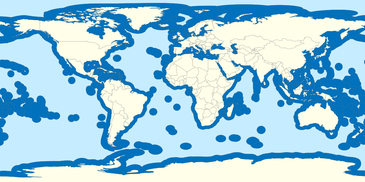
- 200-nautical-mile EEZ boundaries surrounding all coastal states and remote islands
- High Seas ('The Area') designated as the common heritage of mankind
- Median baseline delimitation lines resolving bilateral maritime disputes
Image credit and reuse
World exclusive economic zones
B1mbo; via Wikimedia Commons
CC BY-SA 3.0 cl under the individual source record. Metadata added; exact downloaded source reproduction. Display crop may vary by viewport. Retain source credit and terms. Historical mapmaking context is separate from this image reproduction.
The Rhetorical & Ideological Argument
"The oceans are no longer a free international commons (*mare liberum*); coastal states possess sovereign economic rights over marine resources and continental shelf minerals."
- 200-nautical-mile EEZ boundaries surrounding all coastal states and remote islands
- High Seas ('The Area') designated as the common heritage of mankind
- Median baseline delimitation lines resolving bilateral maritime disputes
- Overlapping bilateral claims in actively disputed waters (e.g. South China Sea)