

Piri Reis Map (1513)
"Ottoman naval portolan chart preserving Columbus’s lost Caribbean surveys and South American coastlines"
Drawn by Ottoman admiral Piri Reis in Gallipoli, this surviving third of a world map synthesized Portuguese charts, Islamic maritime lore, and a captured map drawn by Christopher Columbus himself.
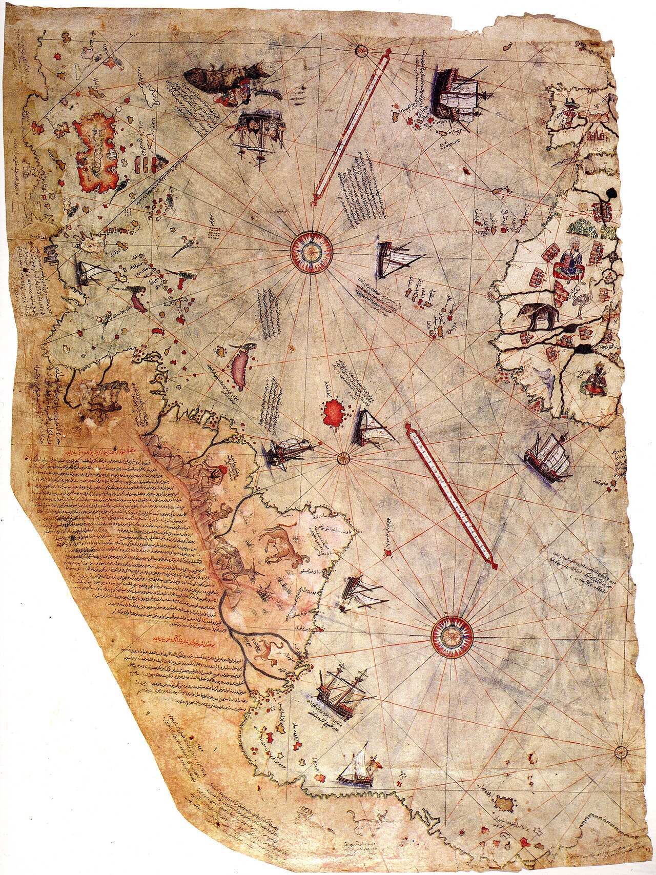
- Accurate depiction of the Andes and South American rivers (Amazon, Rio de la Plata)
- Extensive Ottoman Turkish text inscriptions detailing indigenous fauna and Columbus's expeditions
- Rhumb line intersections centered on Atlantic ocean compass nodes
Image credit and reuse
Piri Reis Map (1513)
Piri Reis; via Wikimedia Commons
Public domain under the individual source record. Metadata added; image pixels unchanged. Display crop may vary by viewport. Retain source credit and terms. Historical mapmaking context is separate from this image reproduction.
The Rhetorical & Ideological Argument
"A demonstration of Ottoman naval reconnaissance parity: proving the Sultanate possessed high-accuracy spatial intelligence on Spanish and Portuguese oceanic discoveries."
- Accurate depiction of the Andes and South American rivers (Amazon, Rio de la Plata)
- Extensive Ottoman Turkish text inscriptions detailing indigenous fauna and Columbus's expeditions
- Rhumb line intersections centered on Atlantic ocean compass nodes
- The missing two-thirds of the map covering Europe, Asia, and Africa