

Ortelius’s Theatrum Orbis Terrarum (1570)
"The world's first modern commercial atlas, standardizing global geographic knowledge"
Published in Antwerp on May 20, 1570, Ortelius's *Theatre of the World* contained 70 maps engraved in a uniform format and scale, including the first catalog of 87 cartographers (*Catalogus Auctorum*).
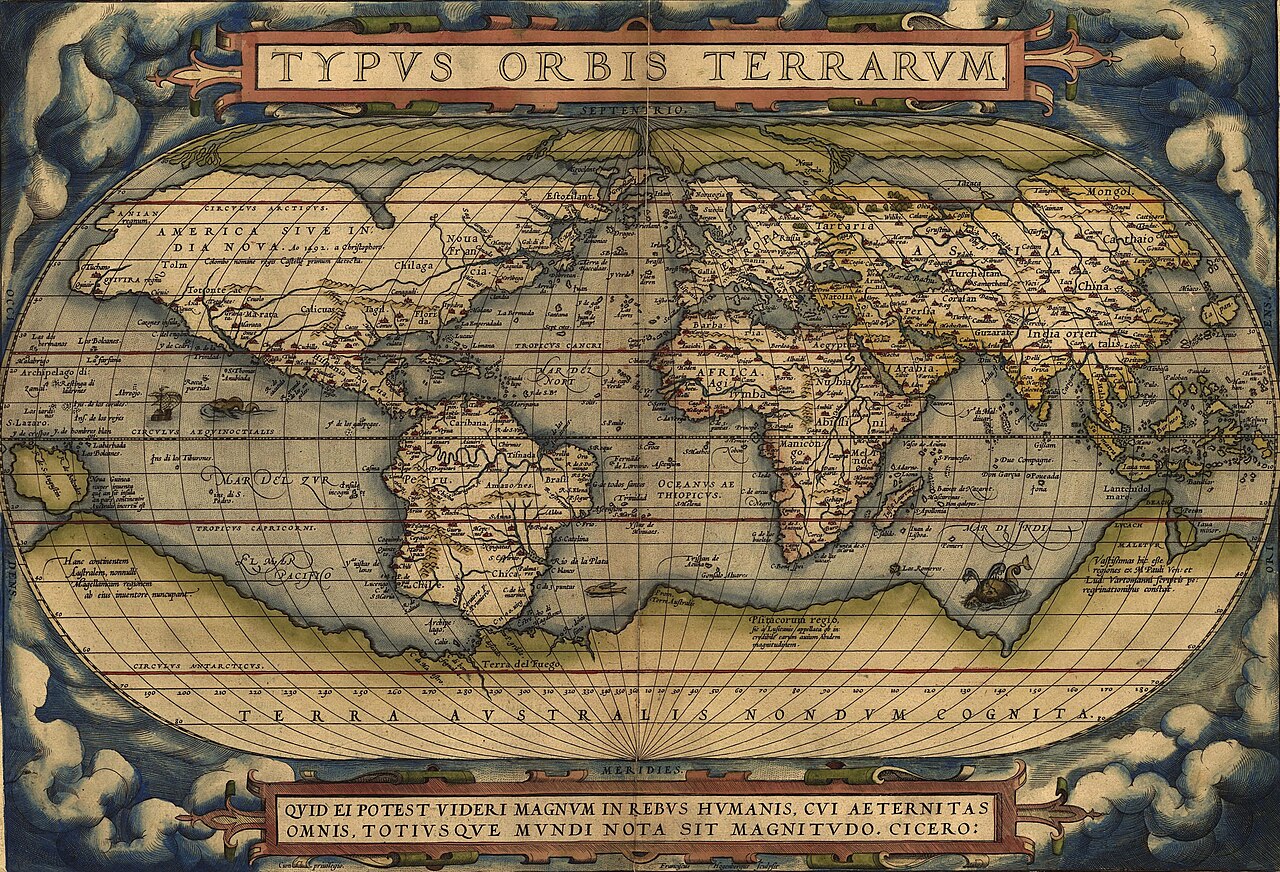
- Uniform book dimensions and standardized visual design across all maps
- Noted that continental shapes fit together like puzzle pieces (first hint of continental drift)
- Lavish decorative sea monsters, galleons, and classical cartouches
Image credit and reuse
Ortelius’s Theatrum Orbis Terrarum (1570)
Abraham Ortelius; via Wikimedia Commons
Public domain under the individual source record. Metadata added; image pixels unchanged. Display crop may vary by viewport. Retain source credit and terms. Historical mapmaking context is separate from this image reproduction.
The Rhetorical & Ideological Argument
"Geography is 'the eye of history' (historiae oculus): a unified commercial book format that allowed European elites to visually comprehend the expanding planetary empire."
- Uniform book dimensions and standardized visual design across all maps
- Noted that continental shapes fit together like puzzle pieces (first hint of continental drift)
- Lavish decorative sea monsters, galleons, and classical cartouches
- Accurate coastlines of Australia and Antarctica