

Marie Tharp & Bruce Heezen’s World Ocean Floor Panorama (1977)
"The map that revealed the Mid-Atlantic Ridge and proved continental drift and plate tectonics"
Working at Columbia University’s Lamont-Doherty Earth Observatory, geologist Marie Tharp painstakingly converted millions of acoustic sonar soundings into 2D depth profiles, discovering the continuous rift valley running down the center of the Atlantic Ocean.
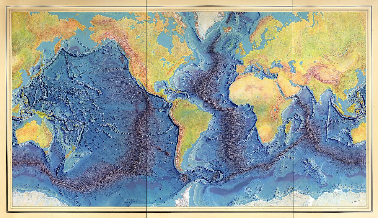
- The 40,000-mile continuous Mid-Ocean Ridge system clearly illuminated
- Deep ocean trenches (Mariana, Puerto Rico) painted in abyssal indigo
- Heinrich Berann's masterful Swiss alpine relief shading applied to underwater canyons
Image credit and reuse
Marie Tharp & Bruce Heezen’s World Ocean Floor Panorama (1977)
Berann, Heinrich C., Heezen, Bruce C., Tharp, Marie.; via Wikimedia Commons
CC0 under the individual source record. Metadata added; image pixels unchanged. Display crop may vary by viewport. Retain source credit and terms. Historical mapmaking context is separate from this image reproduction.
The Rhetorical & Ideological Argument
"The ocean floor is not a flat muddy abyss, but a dynamic volcanic rift system actively generating new Earth crust and moving continents."
- The 40,000-mile continuous Mid-Ocean Ridge system clearly illuminated
- Deep ocean trenches (Mariana, Puerto Rico) painted in abyssal indigo
- Heinrich Berann's masterful Swiss alpine relief shading applied to underwater canyons
- All water is drained away to expose pure bathymetric topography