

Hereford Mappa Mundi
"The largest surviving medieval world map, placing Jerusalem at the center and Christ at the summit"
A monumental encyclopedia of medieval Christian cosmology, depicting over 420 cities, 15 biblical battles, 33 plants and animals, and 32 monstrous human races along the southern periphery of Africa.
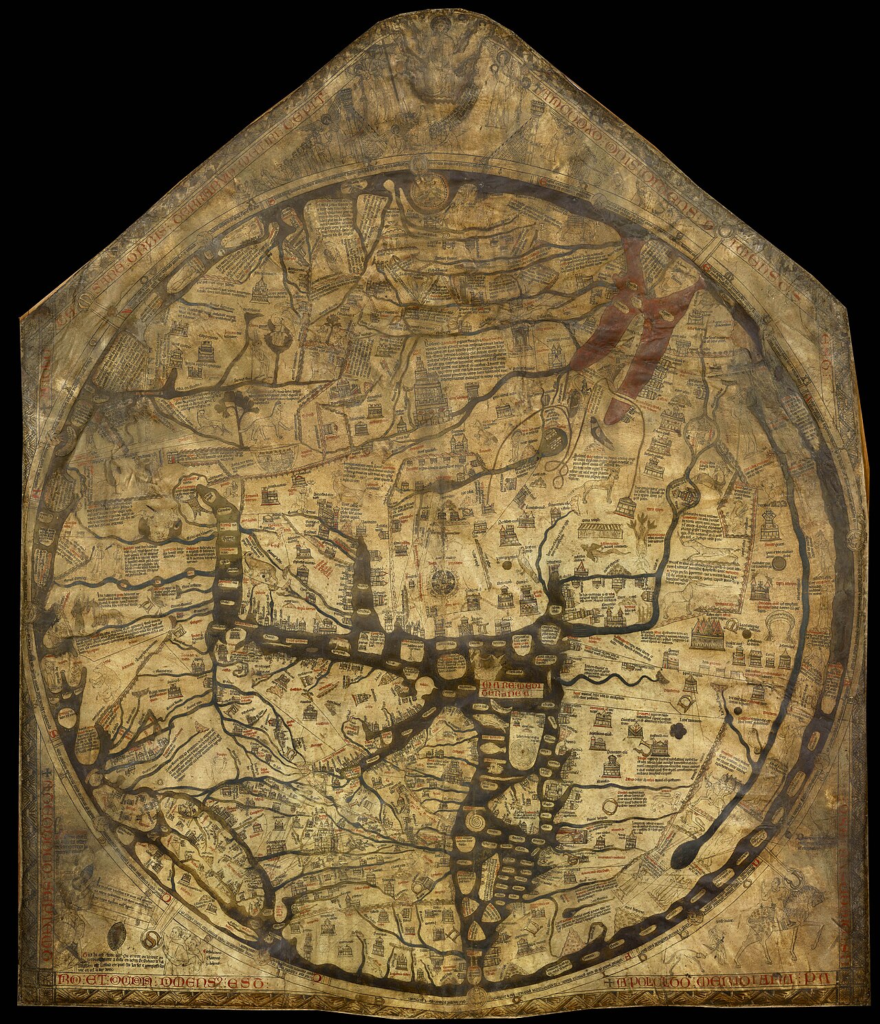
- Jerusalem positioned as the exact geometric navel (umbilicus mundi)
- Garden of Eden at the top (East) surrounded by flaming walls
- Tower of Babel, Red Sea crossing, and Noah's Ark clearly illustrated
- Blemmyae (headless men) and Sciapods (one-legged shade-makers) on the edges
Image credit and reuse
Hereford Mappa Mundi
Maker unidentified in the source record; via Wikimedia Commons
Public domain under the individual source record. Metadata added; image pixels unchanged. Display crop may vary by viewport. Retain source credit and terms. Historical mapmaking context is separate from this image reproduction.
The Rhetorical & Ideological Argument
"The map is not a tool for physical wayfinding, but a spiritual pilgrimage: the Earth is the stage of human salvation, oriented toward Paradise in the East with Christ judging humanity at the cosmic summit."
- Jerusalem positioned as the exact geometric navel (umbilicus mundi)
- Garden of Eden at the top (East) surrounded by flaming walls
- Tower of Babel, Red Sea crossing, and Noah's Ark clearly illustrated
- Blemmyae (headless men) and Sciapods (one-legged shade-makers) on the edges
- Accurate metric distances; geography is bent to serve biblical exegesis