

Buckminster Fuller’s Dymaxion AirOcean World Map (1954)
"Unfolding the globe onto an icosahedron to show Spaceship Earth as one continuous island"
Patented in 1954, Fuller's Dymaxion map projected the globe onto 20 equilateral triangles, unfolding them with zero standard 'North-Up' orientation to reveal all seven continents connected in one continuous landmass.
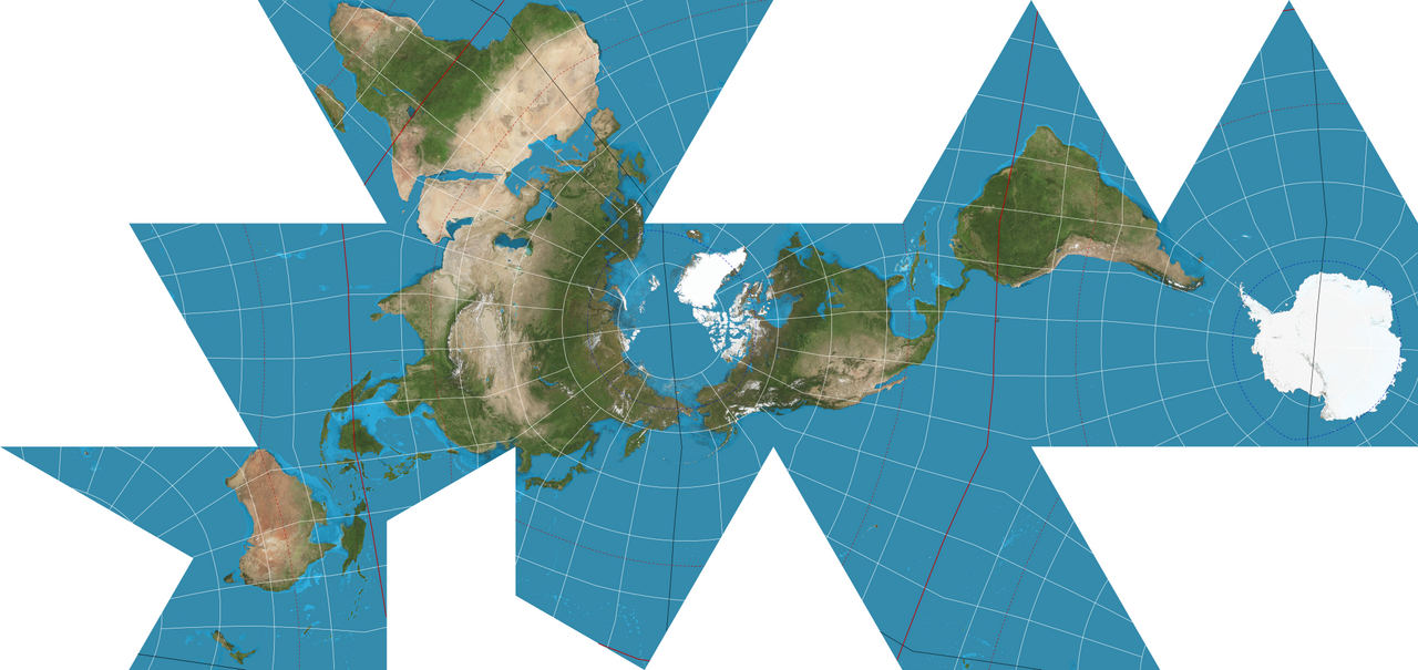
- Earth presented as one continuous island in one continuous ocean
- No cardinal top or bottom; can be viewed from any angle
- Minimal local area and shape distortion across all continental landmasses
Image credit and reuse
Dymaxion projection — Justin Kunimune diagram
Justin Kunimune; via Wikimedia Commons
Public domain under the individual source record. Metadata added; image pixels unchanged. Display crop may vary by viewport. Retain source credit and terms. Historical mapmaking context is separate from this image reproduction.
The Rhetorical & Ideological Argument
"A planetary ecological manifesto against nationalist chauvinism: Earth has no 'Up' or 'Down' in space; humanity shares one single global ecosystem."
- Earth presented as one continuous island in one continuous ocean
- No cardinal top or bottom; can be viewed from any angle
- Minimal local area and shape distortion across all continental landmasses
- Continuous maritime ocean routes (oceans are heavily interrupted)