

Fra Mauro World Map (1459)
"The greatest map of the Middle Ages, abandoning religious dogma for empirical maritime exploration"
Composed on the island of Murano in Venice, Fra Mauro's massive 2.4-meter map contains over 3,000 text inscriptions. It famously rejected placing Jerusalem at the center, stating that Jerusalem is central spiritually, but geographically situated in the Mediterranean temperate zone.
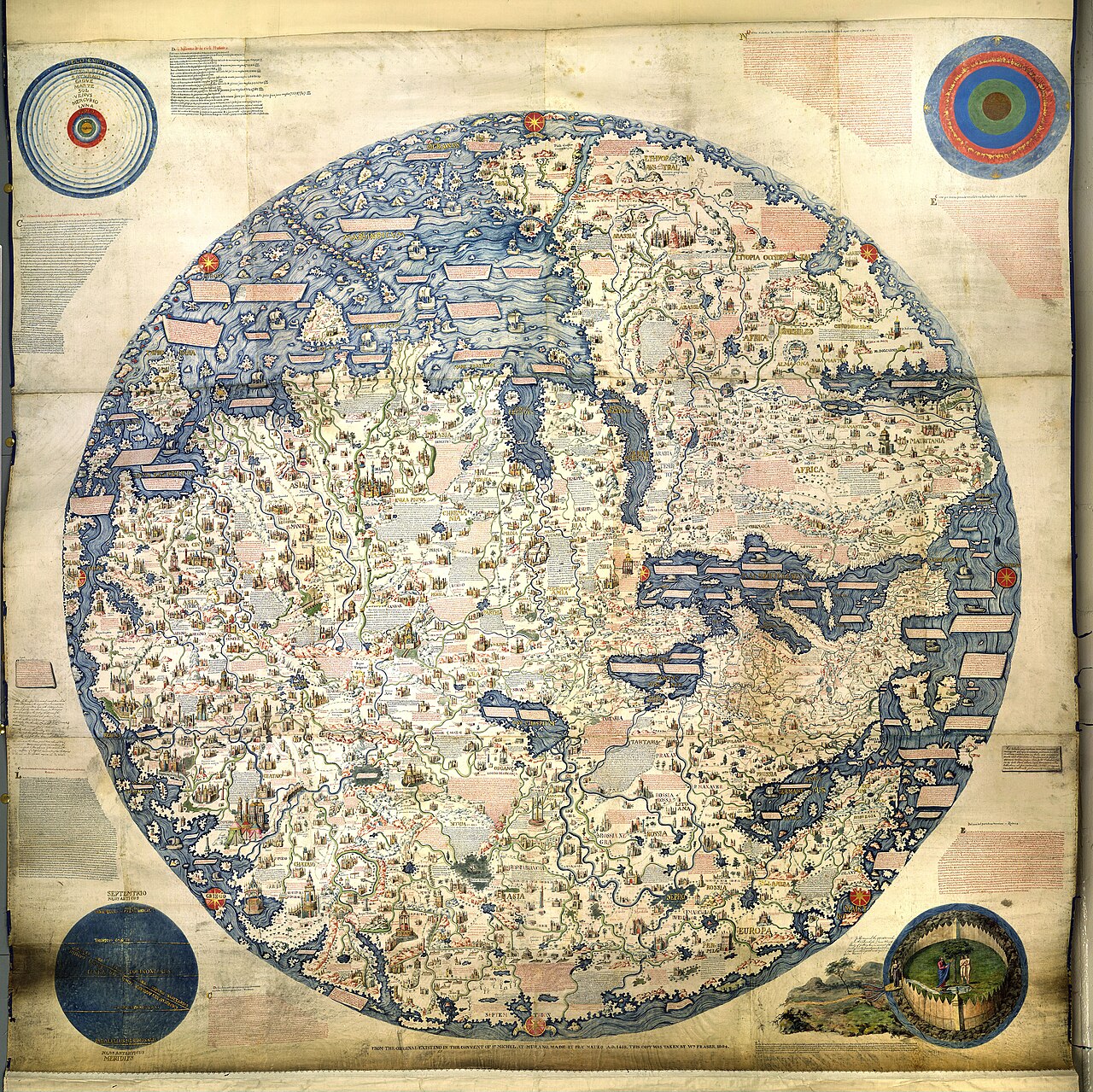
- Proves the Atlantic Ocean and Indian Ocean are connected around the southern tip of Africa (30 years before Vasco da Gama sailed it)
- Over 3,000 detailed Latin and Venetian vernacular annotations
- South-Up orientation celebrating the Indian Ocean trade network
Image credit and reuse
Fra Mauro world map — 1806 copy
Fra Mauro (W. Fraser); via Wikimedia Commons
Public domain under the individual source record. Metadata added; image pixels unchanged. Display crop may vary by viewport. Retain source credit and terms. Historical mapmaking context is separate from this image reproduction.
The Rhetorical & Ideological Argument
"The definitive intellectual pivot from medieval theology to empirical Renaissance geography: verifying coastlines through the reports of Portuguese and Venetian mariners."
- Proves the Atlantic Ocean and Indian Ocean are connected around the southern tip of Africa (30 years before Vasco da Gama sailed it)
- Over 3,000 detailed Latin and Venetian vernacular annotations
- South-Up orientation celebrating the Indian Ocean trade network
- The Americas (created 33 years before Columbus's 1492 voyage)