

Return to Map Specimen Database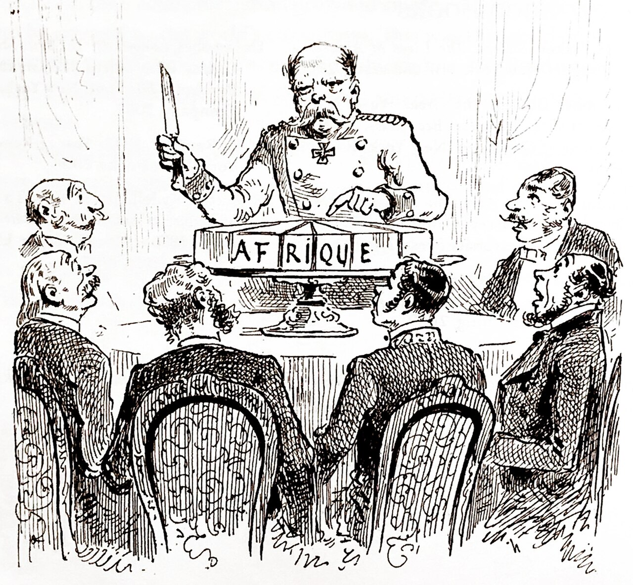
Era: Thematic & Scientific Revolution·Historical mapmaker: Imperial German Foreign Office / Justus Perthes Gotha·Year: 1885·Image reuse: CC0
The Berlin Conference General Act Partition Map of Africa (1885)
"The imperial treaty map carving Africa into colonial spheres of influence with straight-edge ruler lines"
Finalized at the 1884–1885 Berlin West Africa Conference, this map codified European spheres of influence, establishing geometric borders across 50 colonies with zero African participation.
Interactive Specimen Pan & ZoomAccession: FO 925/1610
Orientation: North-Up
1,120 × 950 mm
Maker unidentified in the source record; via Wikimedia Commons·Reproduction·Image source record
ZOOM: 100%Repository Archive
Notable Cartographic Signatures
- Straight ruler lines and astronomical parallels cutting across ethnic boundaries
- The Congo Free State designated as King Leopold II's personal commercial territory
- Spheres of influence color-coded by European imperial power (British, French, German, Portuguese)
Image credit and reuse
Berlin Conference — 1885 caricature
Maker unidentified in the source record; via Wikimedia Commons
CC0 under the individual source record. Metadata added; image pixels unchanged. Display crop may vary by viewport. Retain source credit and terms. Historical mapmaking context is separate from this image reproduction.
The Rhetorical & Ideological Argument
"Africa is legally an empty slate (*terra nullius*) awaiting European partition, commercial exploitation, and civilizing occupation."
Explicit Features
- Straight ruler lines and astronomical parallels cutting across ethnic boundaries
- The Congo Free State designated as King Leopold II's personal commercial territory
- Spheres of influence color-coded by European imperial power (British, French, German, Portuguese)
Intentional Omissions
- All 1,000+ indigenous ethnic kingdoms, languages, and seasonal transhumance routes
Physical Specimen & Geodesy
Projection:
Equidistant Conic Projection of Africa
Orientation Axis:
North-Up
Physical Medium:
Color lithograph on linen-backed paper
Original Physical Dimensions:
1,120 × 950 mm
Custodial Repository:
The National Archives (UK) / Gotha Map Collection
Accession: FO 925/1610
Interdisciplinary Context & Connections
Jurisprudence & CadastreCODIFIES
Colonial Partition Treaties & Sovereignty
Territorial IntelligenceORIGINATES
Post-Colonial African Border Conflict Roots
Academic Provenance: German Foreign Office (1885)