

Babylonian Map of the World (Imago Mundi)
"The oldest known world map depicting Babylon at the cosmic center of the bitter ocean"
Etched on a small clay tablet discovered in Sippar (modern Iraq), the Imago Mundi depicts Babylon as a rectangle straddling the Euphrates River, surrounded by the ocean ring (marru) and eight mythical outer triangular islands (nagu).
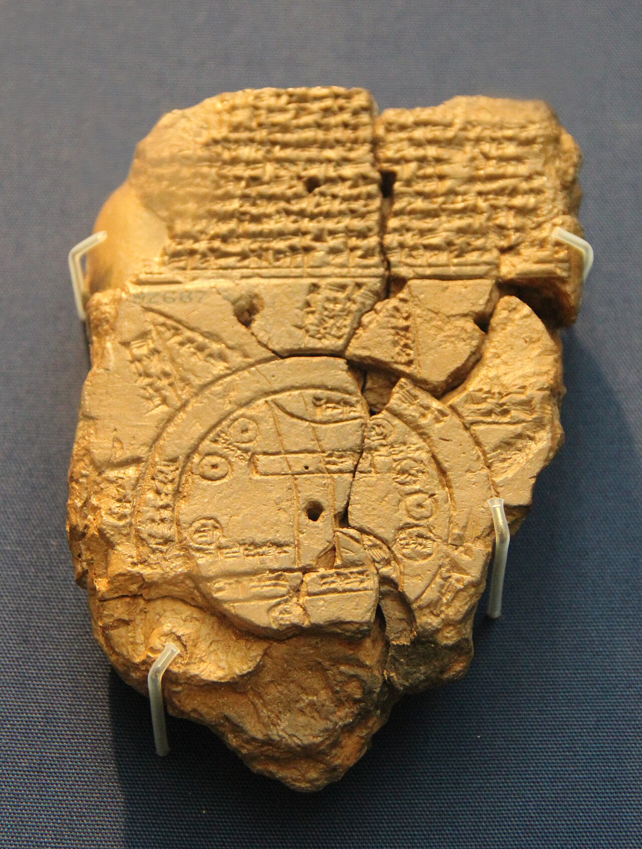
- Babylon positioned prominently at center
- The bitter salty ocean (marru) encircling the earth
- Outer triangular islands where mythical beasts dwell
- Euphrates river bisecting the central disk
Image credit and reuse
Babylonian Map of the World (Imago Mundi)
Gary Todd; via Wikimedia Commons
CC0 under the individual source record. Metadata added; image pixels unchanged. Display crop may vary by viewport. Retain source credit and terms. Historical mapmaking context is separate from this image reproduction.
The Rhetorical & Ideological Argument
"A theological and geopolitical assertion that Babylon is the cosmic hub of the universe, linking earthly territorial power directly to divine celestial order while banishing alien beasts to outer mythological triangles."
- Babylon positioned prominently at center
- The bitter salty ocean (marru) encircling the earth
- Outer triangular islands where mythical beasts dwell
- Euphrates river bisecting the central disk
- Egypt, Greece, and Persia omitted to preserve Babylon's absolute central dominance