

Al-Idrisi’s Tabula Rogeriana (Nuzhat al-Mushtaq)
"The medieval Islamic masterwork created for King Roger II of Sicily, drawn South-Up"
Created over 15 years in Palermo by Arab scholar Al-Idrisi for the Norman Christian King Roger II, this 70-sheet atlas combined Islamic maritime knowledge, Ptolemaic coordinates, and interviews with Mediterranean sailors into the most accurate map of the Middle Ages.
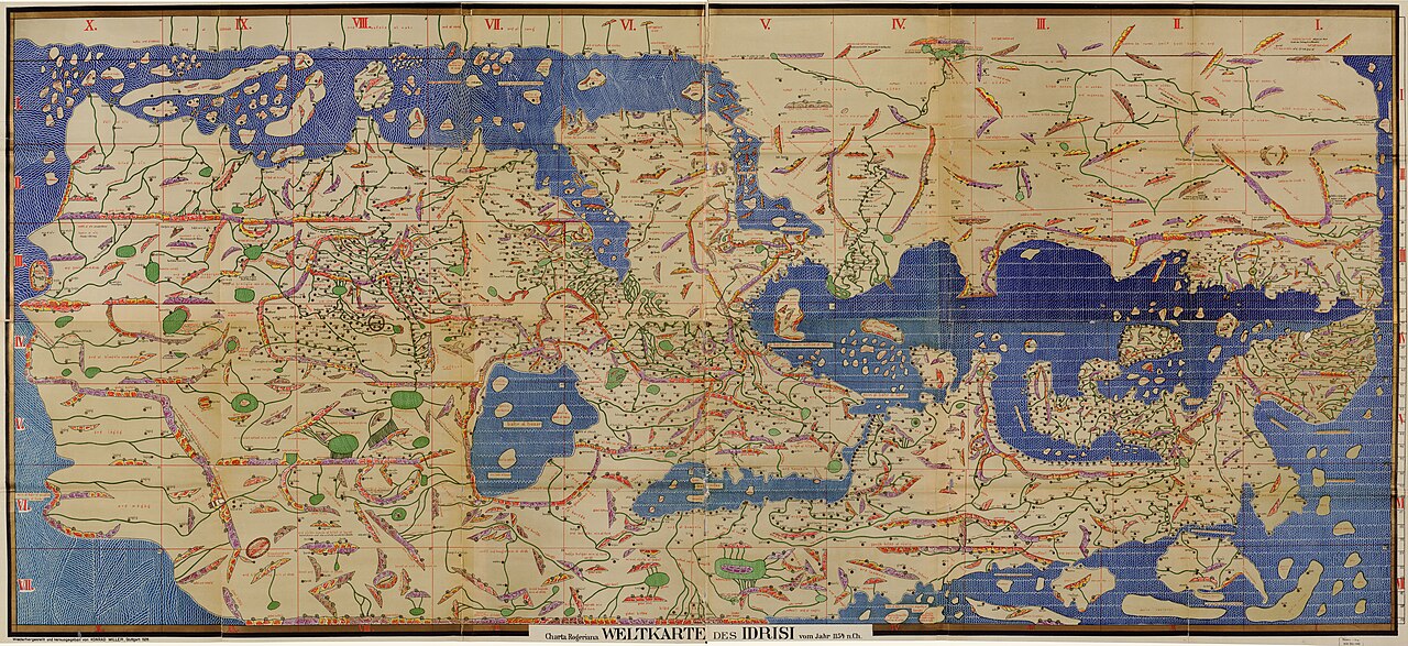
- South-Up orientation with Mecca and the Islamic world situated above Europe
- Detailed Nile river basin with Lake Victoria-like source lakes
- Detailed Mediterranean coastlines with hundreds of port towns
Image credit and reuse
Tabula Rogeriana — Konrad Miller reconstruction
Konrad Miller; via Wikimedia Commons
Public domain under the individual source record. Metadata added; image pixels unchanged. Display crop may vary by viewport. Retain source credit and terms. Historical mapmaking context is separate from this image reproduction.
The Rhetorical & Ideological Argument
"A triumph of multicultural scientific synthesis: proving that Arab and European geographical knowledge could unite to represent the habitable globe with South at the top."
- South-Up orientation with Mecca and the Islamic world situated above Europe
- Detailed Nile river basin with Lake Victoria-like source lakes
- Detailed Mediterranean coastlines with hundreds of port towns
- Southern African cape (depicted as curling eastward into Asia)